Garmin GPSMAP 8417 MFD
Garmin GPSMAP 8417 MFD

Customer Service
Customer Service
Clienții ne apreciează pentru cunoștințele avansate despre produsele pe care le vindem.
Garantia Calitatii
Garantia Calitatii
Nu esti multumit de produsul pe care l-ai cumpărat? Îl schimbam fără griji in 14 zile
Garantie produs
Garantie produs
Toate produsele de pe Spinninshop.ro beneficiază de garanție conform legislației în vigoare. Asigurăm calitate și durabilitate, iar echipa noastră este pregătită să ofere suport rapid și soluții eficiente pentru orice problemă legată de produsele achiziționate.
Plata in siguranta si in rate
Plata in siguranta si in rate
Avem multiple posibilități de plata, inclusiv plata in rate prin TBI.
Livrare rapidă
Livrare rapidă
Livram in maxim 48 de ore produsele pe stoc si in 4-5 zile produsele aflate in stocul furnizorilor
Suntem recunoscuți în rândul pescarilor pentru serviciile excelente de consultanță pe care le oferim. Folosim produsele pe care le vindem și cunoaștem toate detaliile despre ele. Sunt aici să te ajut. Contactează-mă cu încredere!

Claudiu
Contactează-mă pentru consultanță
Tel/Whatsapp: 0760522222
16” Touchscreen Chartplotter with Full HD In-plane Switching (IPS) Display
- Features a 16” full HD IPS touchscreen display
- Fully network capable with NMEA 2000® connectivity and the Garmin Marine Network
- Includes ANT® technology and Wi-Fi® networking
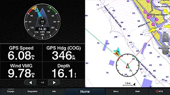
- Garmin SailAssist™ feature provides critical sailing data and displays prerace guidance for racers
- SmartMode™ station controls enable quick, one-touch access to the information you need
- Disponibil doar la comanda

Serious cruisers, sailors and sail racers demand serious equipment. The easy-to-use, easy-to-install GPSMAP 8416 chartplotter delivers MFD performance in a combo-size package. It features a 16” full HD IPS touchscreen display for wider viewing angles, superior clarity and sunlight readability, even with polarized sunglasses. Multiple displays can be flat mounted edge-to-edge to create a sleek glass helm look or can be mounted flush. It also provides standard USB touch output for use as a touchscreen monitor for Windows® and Mac® operating systems.
Build Your Marine System

NMEA 2000 networking and the Garmin Marine Network allow you to easily build your full marine electronics suite — from radar and autopilots to cameras, instruments and forward-looking sonar — controlled from your chartplotter and shared across multiple screens. In addition, our exclusive OneHelm™ system coordinates many third-party manufactured onboard marine products to bring full control of systems — such as digital switching, lighting, stabilization and more — conveniently to your chartplotter screen.
Full Connectivity
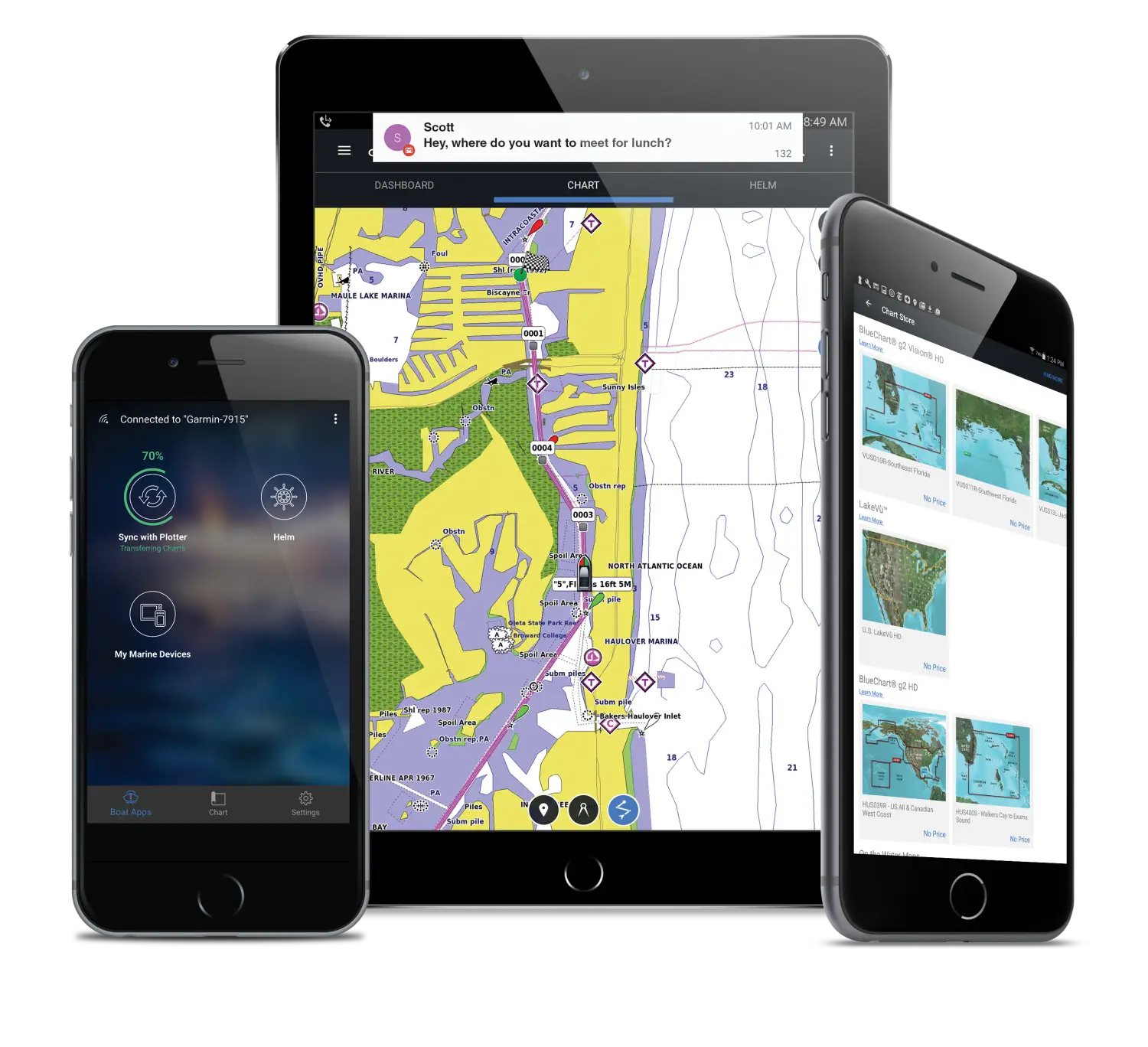
The GPSMAP 8416 chartplotter has a premium-performance processor that enables fast map drawing, superior networking, video distribution and more. Built-in Wi-Fi technology lets you pair with the free ActiveCaptain® app for access to OneChart™, smart notifications¹, Garmin Quickdraw™ community data and more. You can also control video streaming from our GC™ 100 wireless camera and VIRB® action cameras. In addition, built-in ANT wireless technology connects you directly to our quatix® marine watch, gWind™ Wireless 2 transducer and wireless remote controls.
SmartMode Station Controls
Networked sonar, radar, cameras, media and digital switching can be independent or incorporated into SmartMode station controls. With SmartMode, everything is designed to give you quick, one-touch access to the information you need to ease high-stress situations such as docking.
The Best of Garmin with the Best of Navionics®

For the most detailed, clear and concise charts and maps, GPSMAP 8416 includes expandable memory for accessory map purchases such as BlueChart® g3 and BlueChart® g3 Vision featuring Navionics data. The charts and maps also include our Auto Guidance technology, which shows a suggested route to a destination², based on your boat’s specifications.
Sit Back and Take Control

You don’t have to stand for hours at the helm. The optional easy-to-use GRID™ 20 remote input device provides intuitive remote access and control of your entire Garmin marine system. It features a 360-degree joystick with a rotary knob and push-to-select button for easy chartplotter menu/setting navigation and fine control, even in the worst conditions.
Special Sailing Features

To help you make informed decisions, the Garmin SailAssist feature provides critical data displays and prerace guidance to help you gain a competitive edge. Other sailing features include laylines, enhanced wind rose, heading and course-over-ground lines, true wind data fields and tide/current/time slider. Gauge displays provide need-to-know information at a glance, including true and apparent wind angle, set and drift, true or apparent wind speed, horizontal or vertical graphs and a data bar with customizable fields.
The Ultimate Connected Boating App


